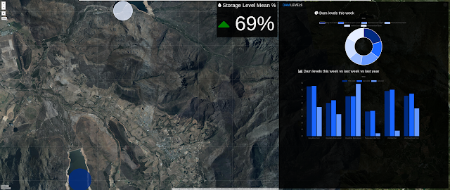
Welcome to the Web Scraping and Mapping Dam Levels in Python and Leaflet. In this series we will be building a python GIS application from scratch, using a variety of open source technologies. The purpose of this series and many more to follow, is to take geospatial analytics and convert it into a functional application.
We will be powering our application with a PostgreSQL and PostGIS database. In the front-end we'll use Bootstrap, Javascript, and Ajax. The data we will be working with on the front-end will be serialized into geojson format. The mapping library we will use is Leaflet.js, which is a javascript library that is used to build maps and map applications for free. On the server side we will be using Python 3 Django combined with scientific libraries like pandas, for our data transformation and conversion operations. We will also be using web scraping to collect our data from a website, using a library called BeautifulSoup. The operating system that we will be working on is Ubuntu Linux 16.04.
The preview video as well as some free content is available on our YouTube channel to watch. If you like what you see please like and subscribe on the channel and hit the notification button to make sure you're aware of the latest video we will publish.
Web Scraping and Mapping Dam Levels in Python and Leaflet - Intro (Video)
Conclusion
That is about all we need to cover for the introduction to this series. I hope you will enjoy it and it will add some value to the projects you are currently busy with.
Stay tuned for more content coming soon.
Full course available below:


This blog is worth sharing. Thanks. We, the The True Indians based in Delhi and Bangalore, we promote businesses and generate sales that help you take your business to the next level. Please go through our blog to get some amazing posts to read. Thanks
ReplyDeleteAlcohol Brands in India
Vodka Brands in India
Rum Brands in India
Indian mobile phone companies
Indian breed dogs
LONGEST SNAKE IN THE WORLD
ALL POKEMON CHARACTERS
FAMOUS POKEMON CHARACTERS
All Cartoon Characters
Made in india laptop company
HIGHEST MOUNTAIN PEAK IN SOUTH INDIA
BEST GAMING NAMES
Lip Kiss
National Parks in India
Oxygen Producing Plants
Doraemon Cartoon Characters
All Country Code Number
Ninja Hattori Characters Names